Ninska Designs
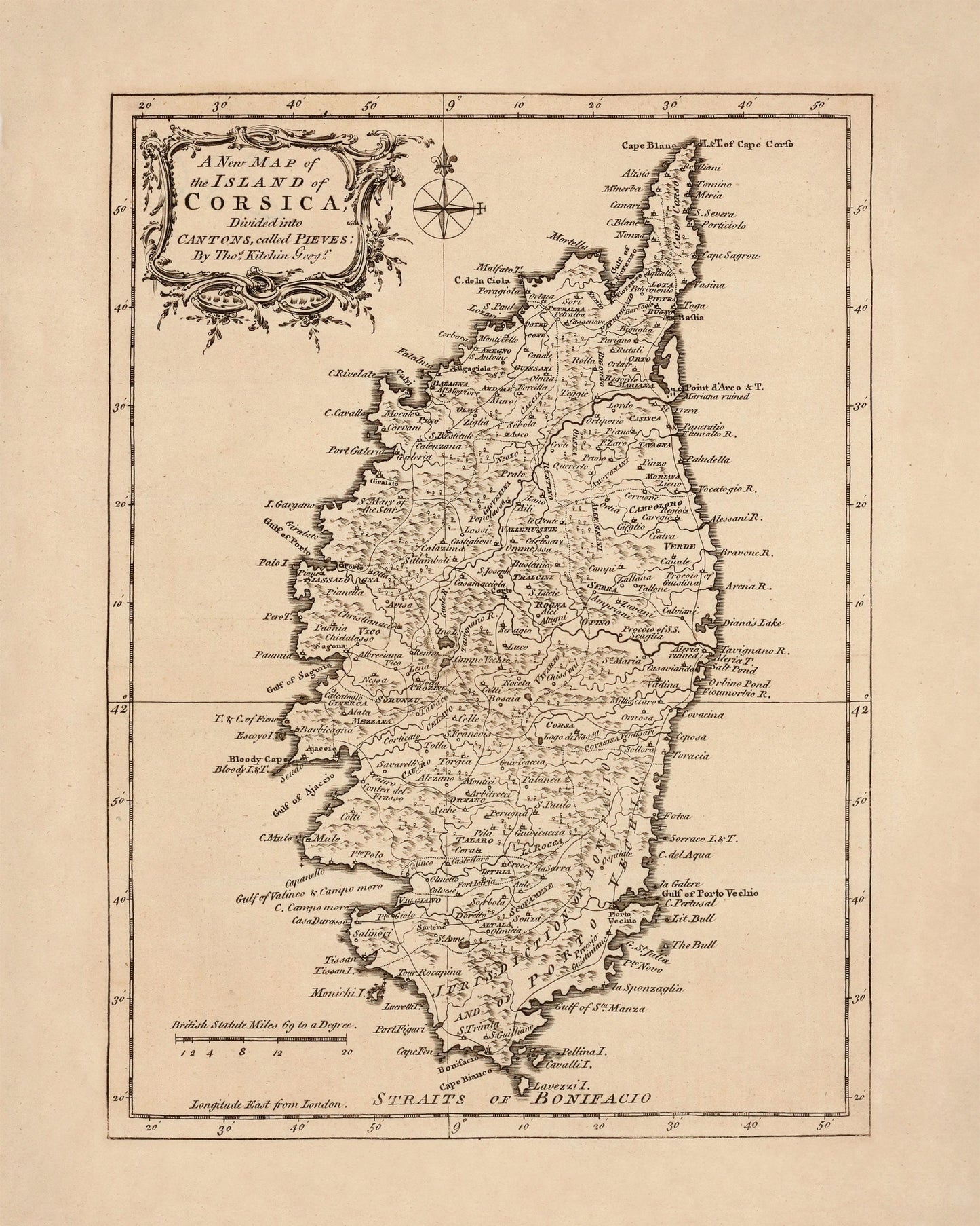
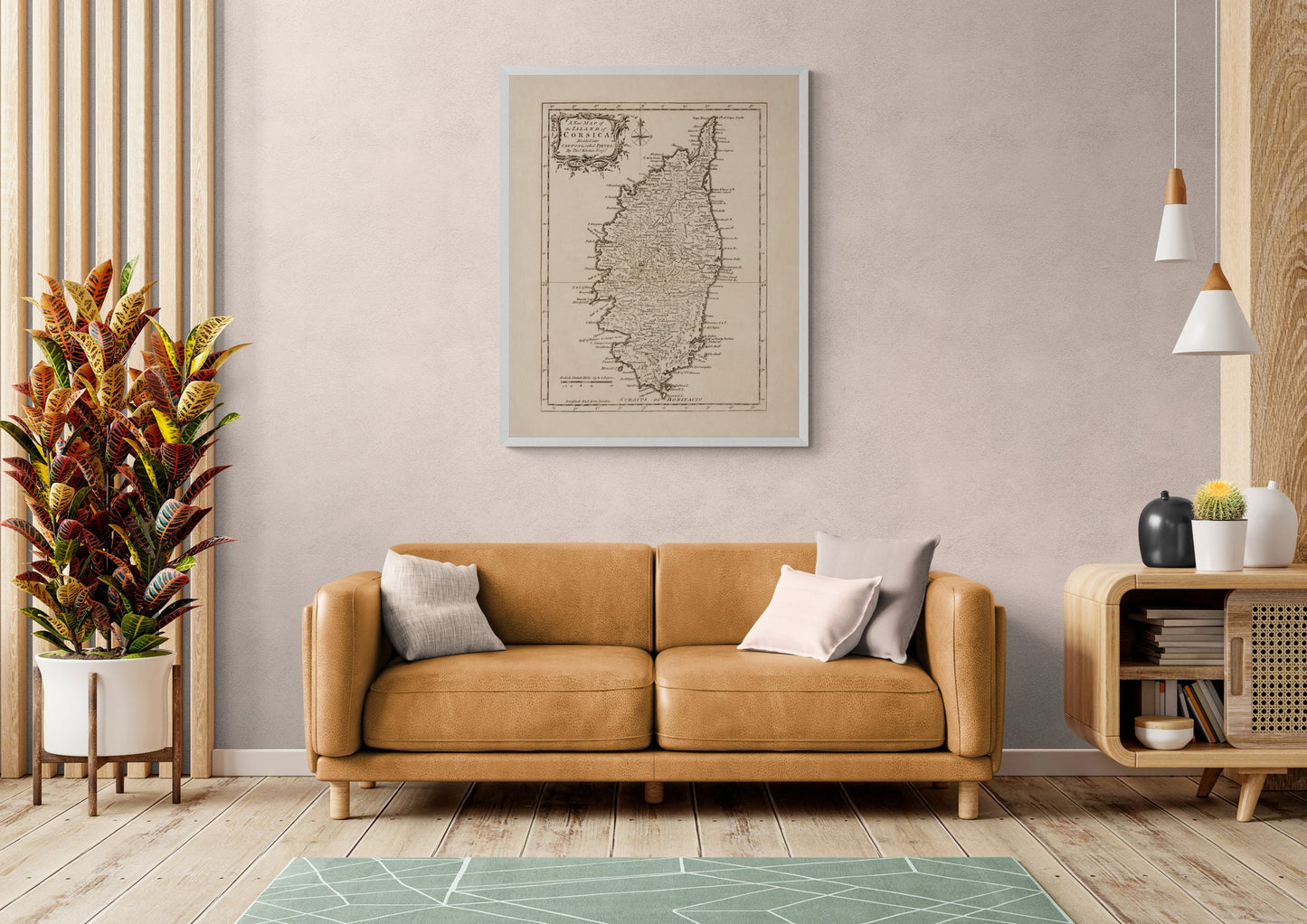
Corsica 18th Century Map
Corsica 18th Century Map
Couldn't load pickup availability
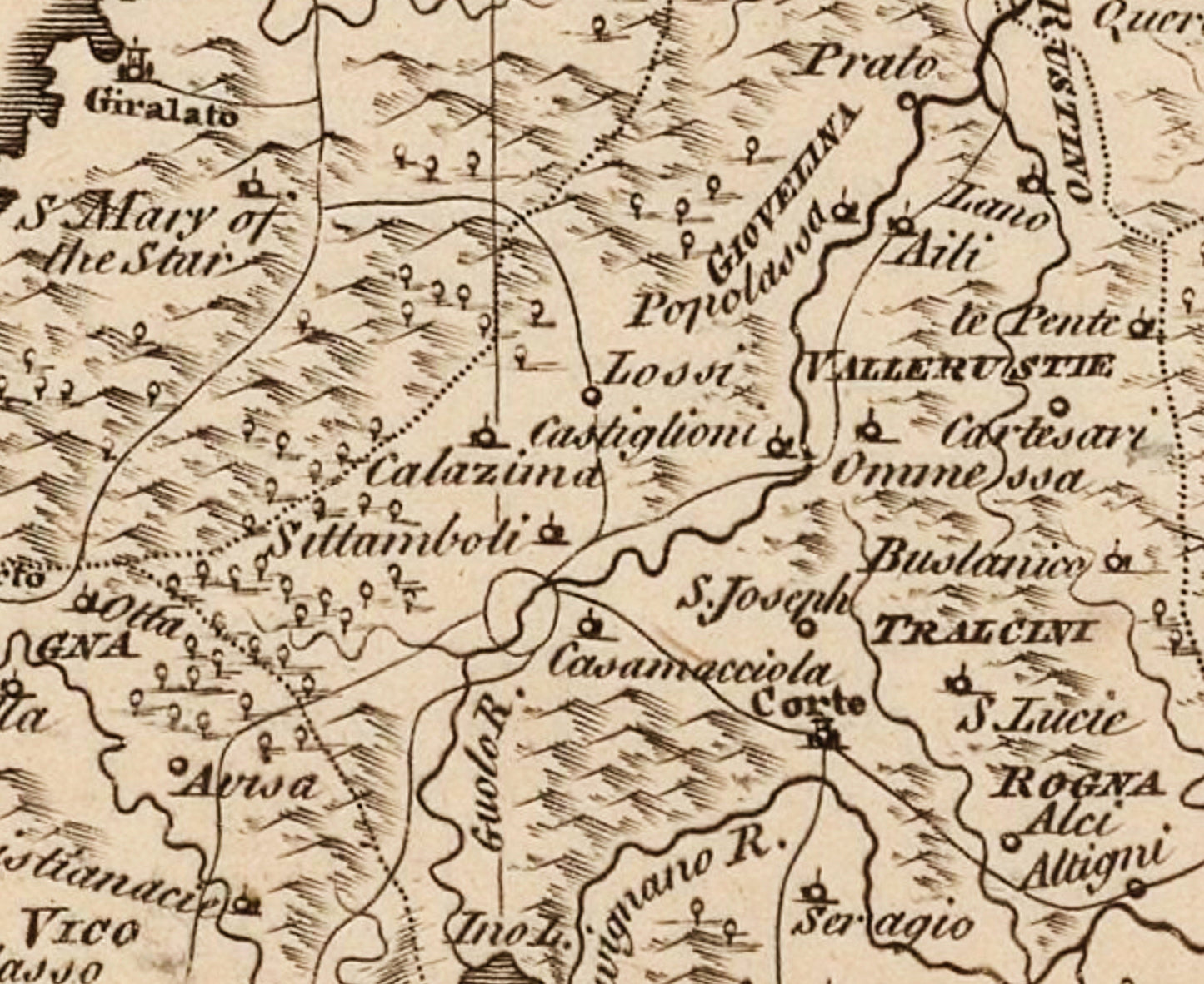
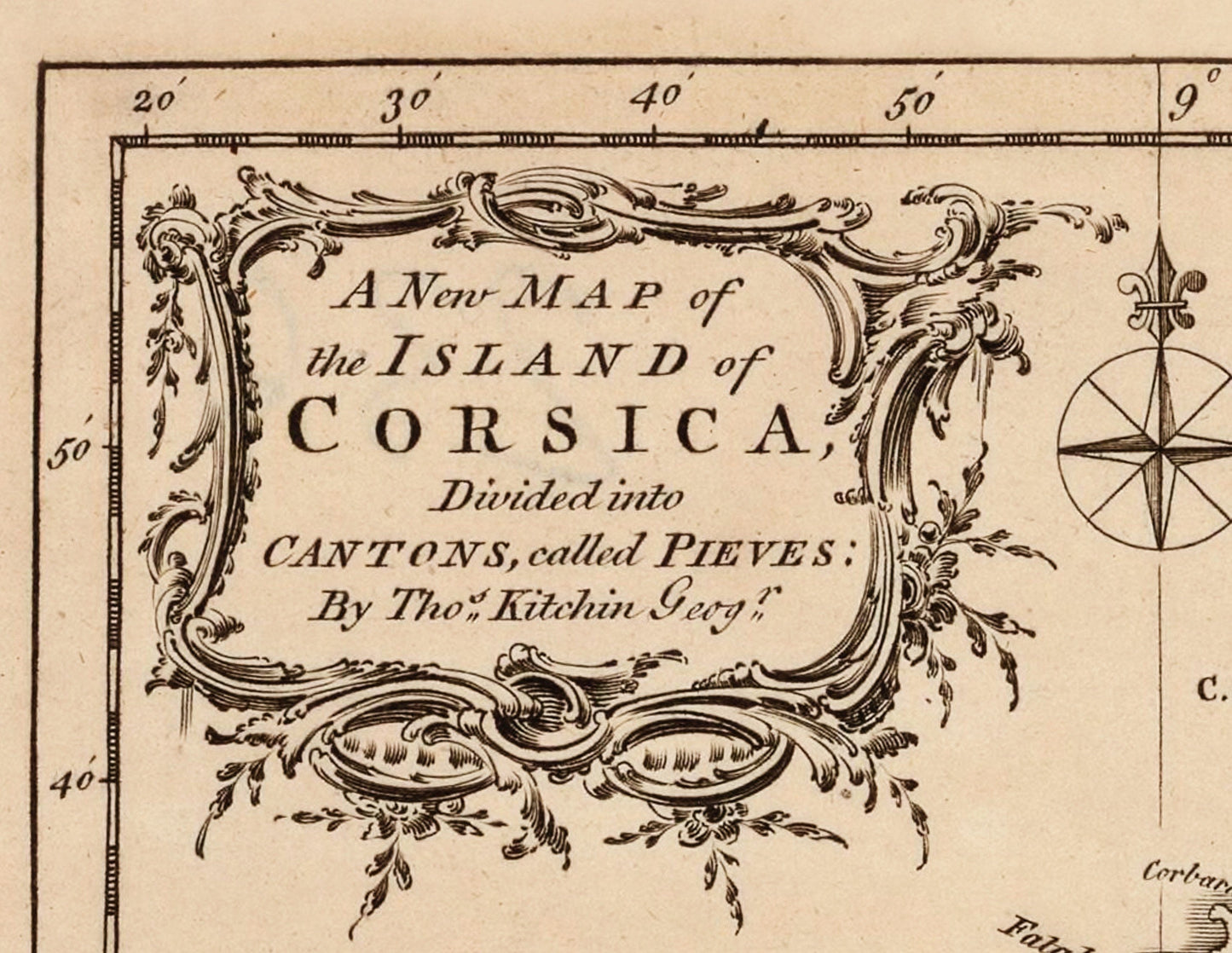
There is something wonderfully rugged and romantic about this antique map of Corsica. Dated 1768, it captures the island in the elegant style of 18th-century cartography, with its pieves, coastline, mountains, and settlements laid out in crisp detail. It has all the appeal of a true collector’s map - scholarly, decorative, and full of Mediterranean character. This is an edited reproduction made from antique/public domain source imagery.
Perfect for a study, hallway, office, library, or travel-inspired interior, this vintage Corsica map print is a brilliant choice for lovers of antique cartography, French history, island heritage, and historic travel decor. It brings together old-world charm and graphic clarity in a way that feels effortlessly stylish on the wall. Whether you have a personal connection to Corsica or simply love unusual antique maps, this is the kind of piece that adds instant depth, story, and quiet sophistication to a room.
Print quality
Printed on 300gsm fine art cotton rag paper using archival pigment inks for superb detail, depth and longevity.
Mounting & Framing
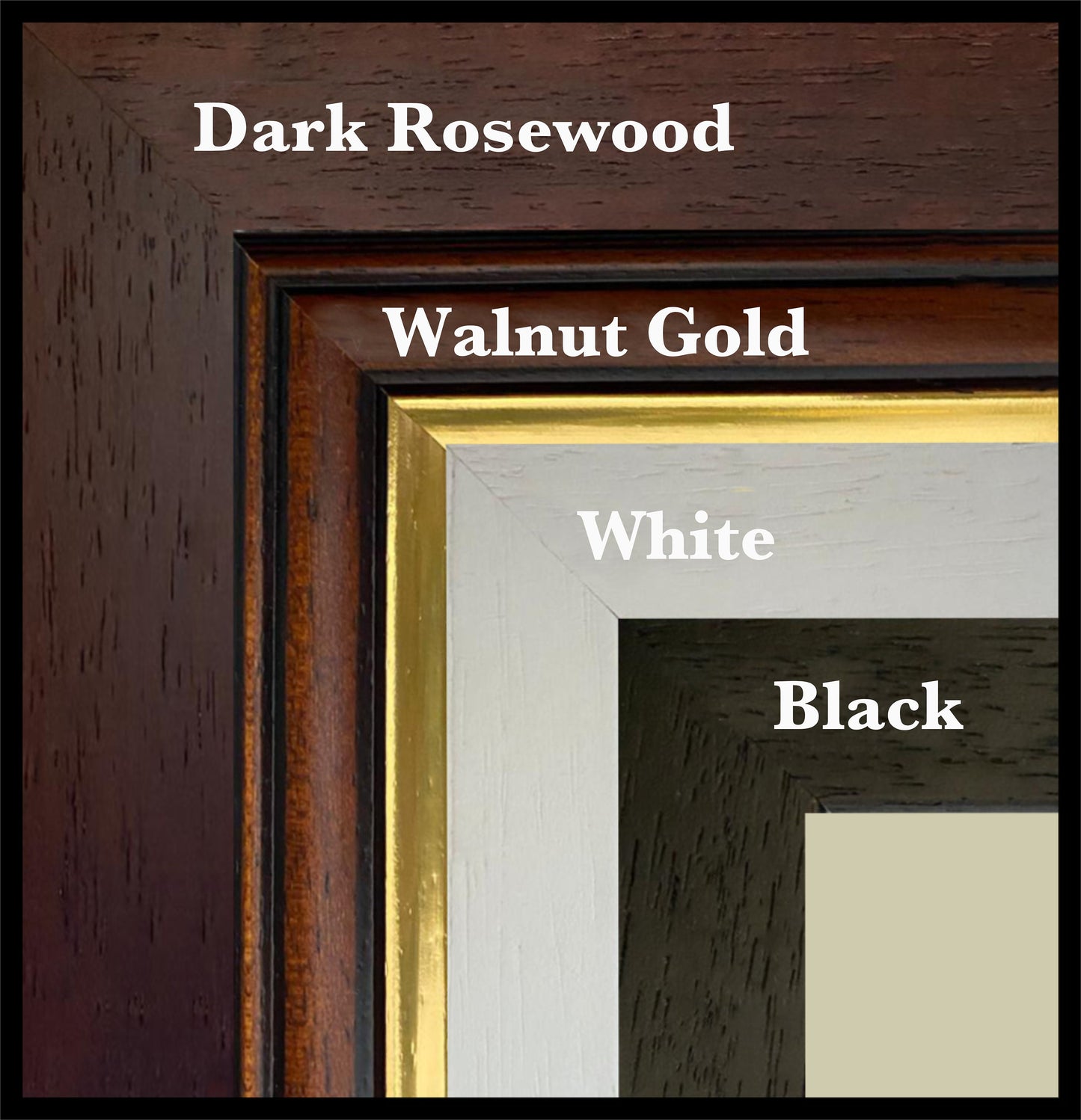
Mounted prints are supplied with an antique white mount as standard, though a black mount is available on request.
Frames are UK-made in solid wood and finished with perspex glazing and an MDF back.
• Black/White – 20mm wide, 15mm deep
• Dark Rosewood – 35mm wide, 15mm deep
• Walnut Gold – 28mm wide, 14mm deep
As wood is a natural material, variations in tone and grain may occur. Not all sizes are available mounted. Sizes refer to the print area.
Attribution
This is an edited version of the following public domain image:
https://commons.wikimedia.org/wiki/File:A_new_map_of_the_island_of_Corsica_divided_into_cantons,_called_pieves_-_by_Tho._Kitchin_-_btv1b53079366s.jpg
Share