Ninska Designs
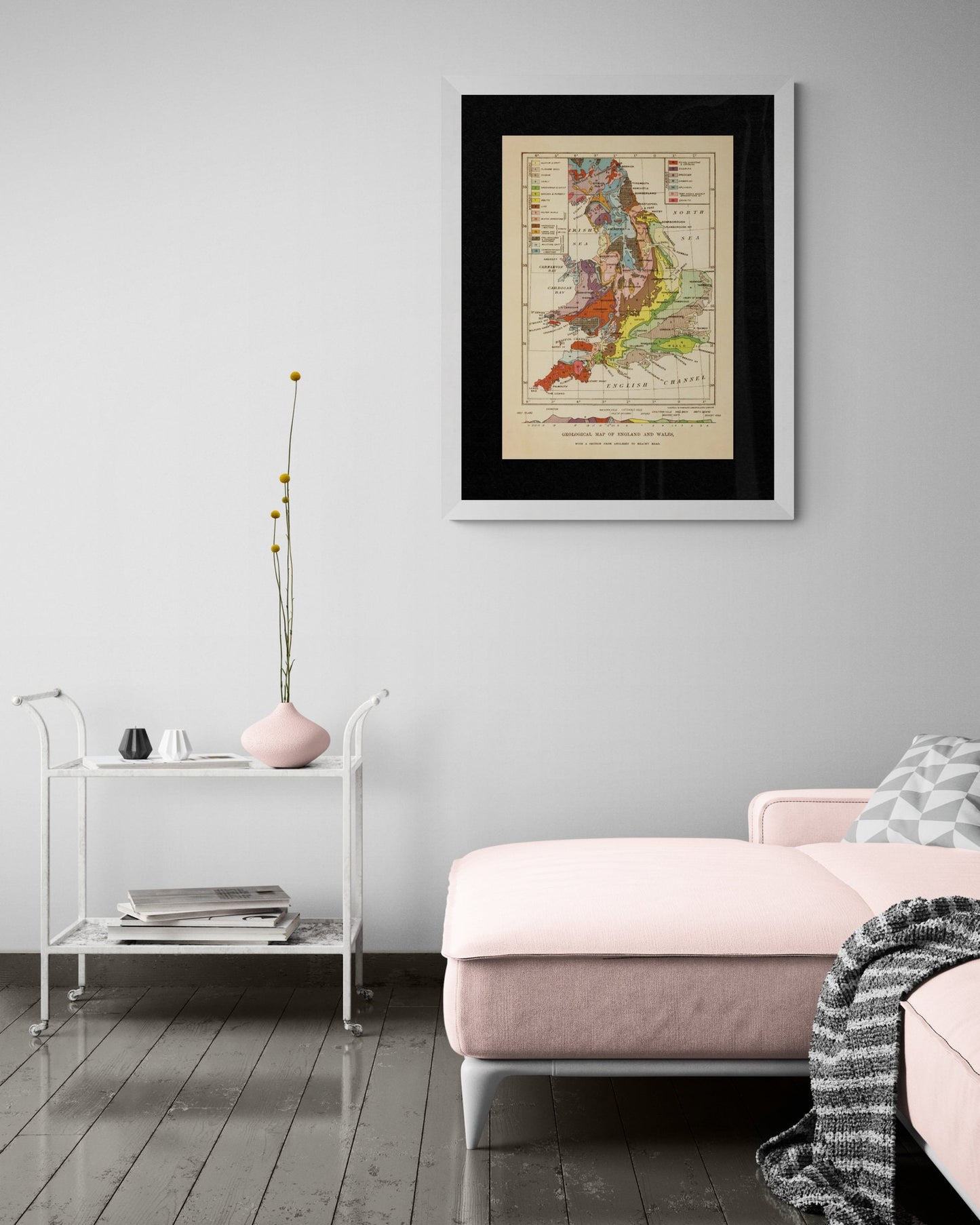
Geological Map of England and Wales
Geological Map of England and Wales
Couldn't load pickup availability
Geological maps have a particular fascination because they show the land twice over, revealing both the familiar outline of a country and the hidden structure beneath it. This antique map of England and Wales does exactly that, with coloured strata, coastal detail and period labelling arranged in the crisp, elegant style that makes nineteenth-century scientific cartography so enduringly appealing. A striking choice for anyone drawn to British geology, vintage map decor and antique science prints, it brings depth, character and a strong sense of place to a study, office, hallway or gallery wall.
This is an edited reproduction made from antique/public domain source imagery.
Print quality
Printed on beautifully textured 300gsm cotton rag paper using archival pigment inks, this reproduction has a crisp, characterful finish that suits antique cartography especially well. The heavyweight fine art paper gives the image depth and presence, while the archival inks help preserve its subtle tones, fine linework and intricate printed detail.
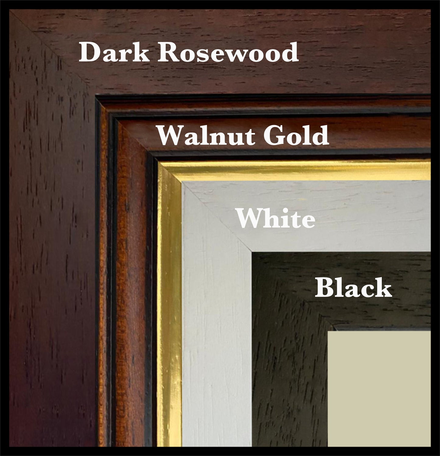
Mounting & Framing
Available unframed, mounted or framed.
Mounted prints are set in an antique white mount as standard, chosen to complement the vintage character of the piece. A black mount is available on request.
Frames are handmade in the UK from solid wood and fitted with perspex glazing and an MDF back.
• Black wood frame - 20mm wide, 15mm deep
• White wood frame - 20mm wide, 15mm deep
• Dark rosewood frame - 35mm wide, 15mm deep
• Walnut gold frame - 28mm wide, 14mm deep
Please note that natural wood grain and finish may vary slightly from frame to frame.
Not all sizes are available mounted. Sizes refer to the print area.
Share