Ninska Designs
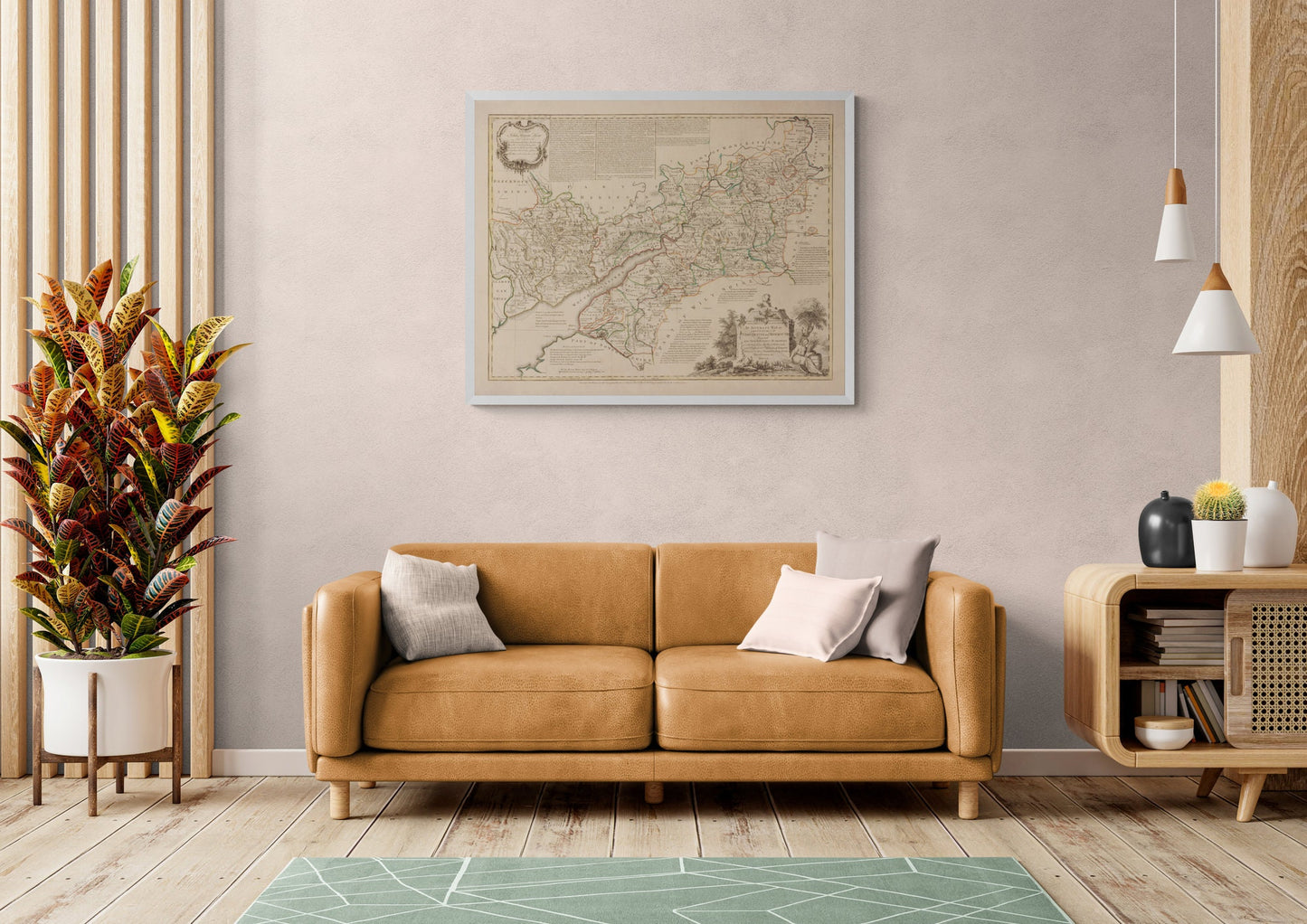
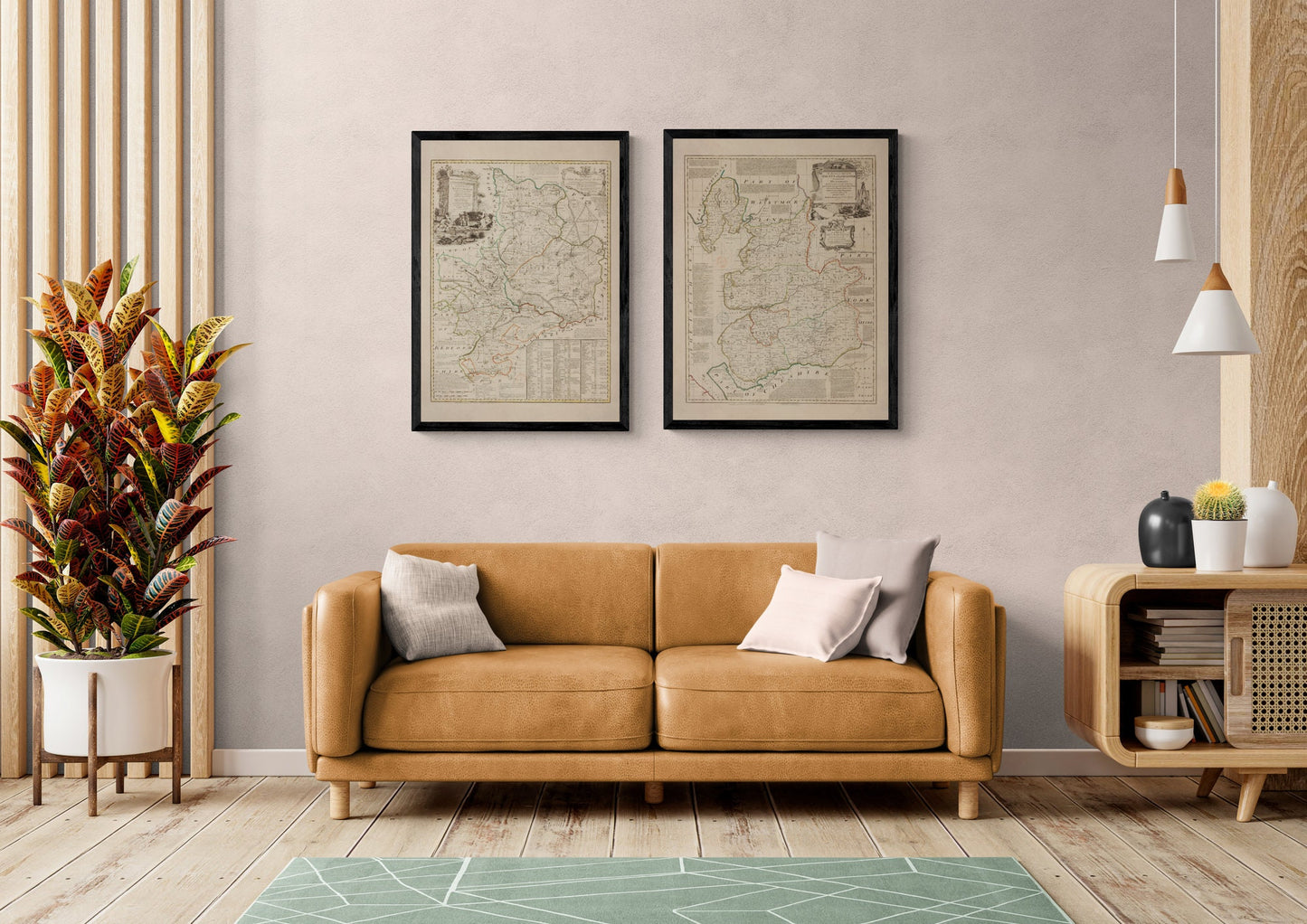
Gloucester and Monmouth Map dated 1760
Gloucester and Monmouth Map dated 1760
Couldn't load pickup availability
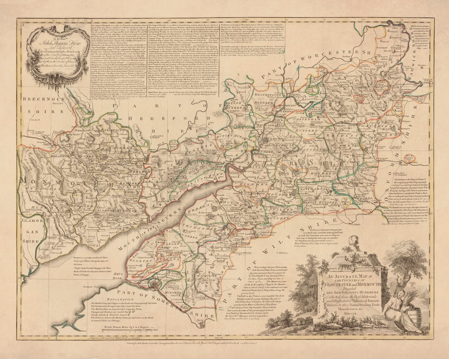
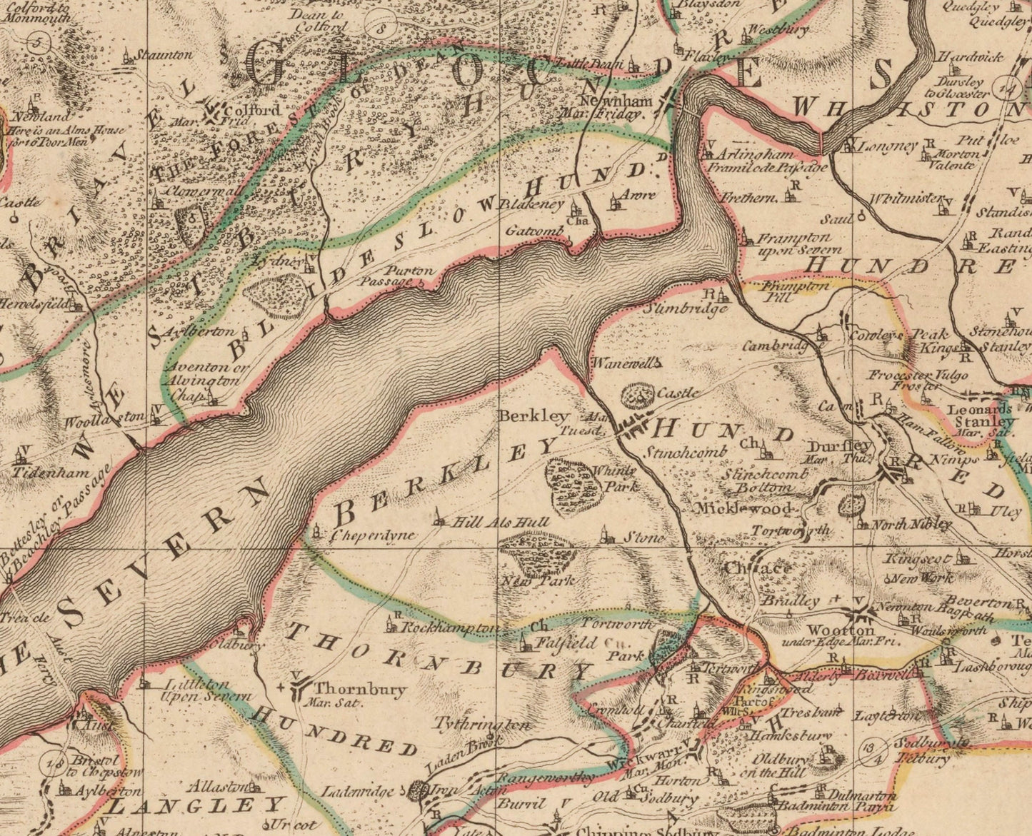
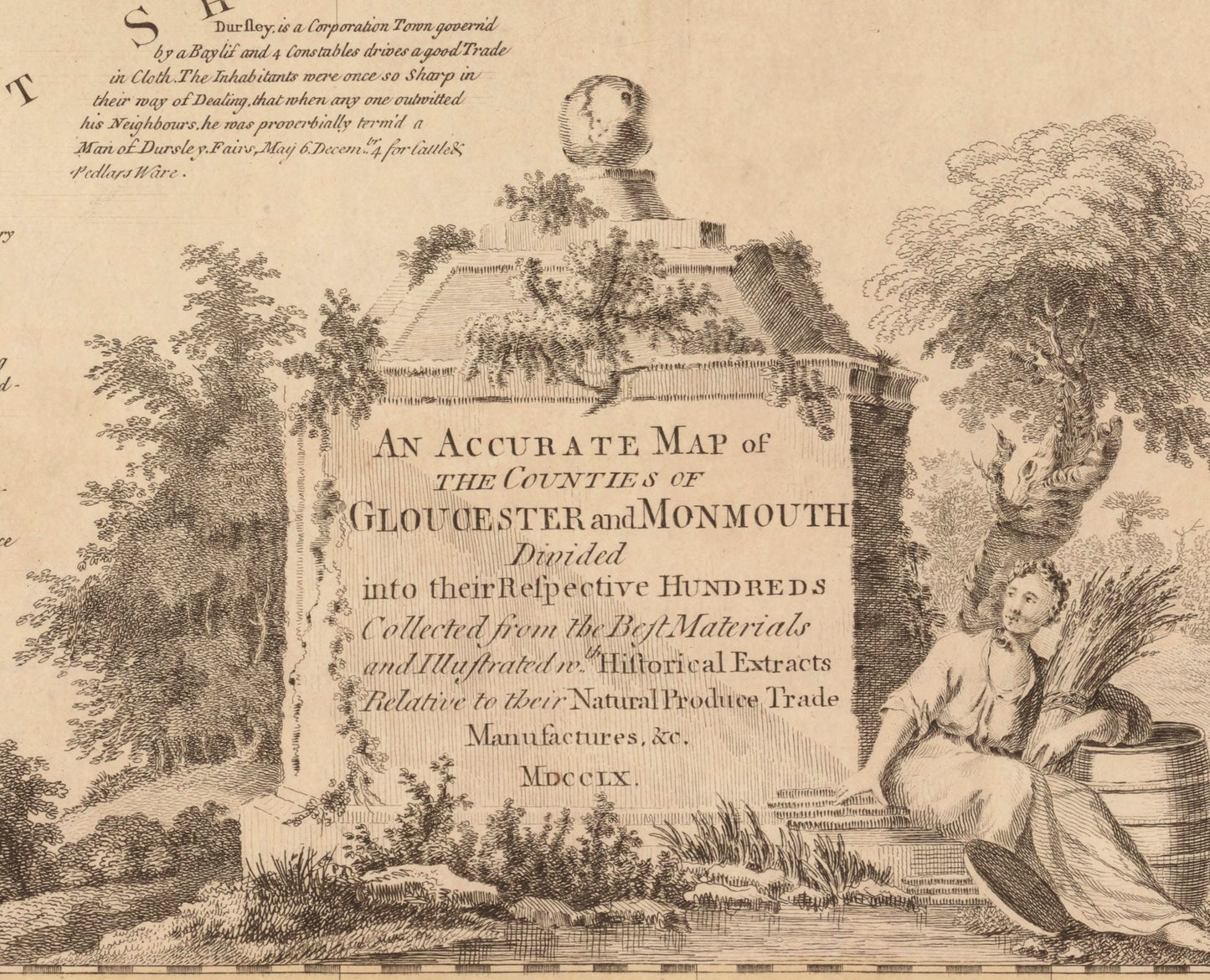
Rich with detail, local character, and the quiet confidence of Georgian mapmaking, this antique Gloucester and Monmouth map dated 1760 is exactly the sort of print that gives a room instant depth. Divided into the historic hundreds and packed with roads, settlements, boundaries, and decorative cartographic detail, it offers far more than a simple county map. It feels like a portrait of the landscape itself - measured, elegant, and full of the stories of Gloucestershire and Monmouthshire. This is an edited reproduction made from antique/public domain source imagery.
For lovers of antique maps, British history, county cartography, and heritage interiors, this print has real pull. It is especially appealing if you have roots in Gloucester, Monmouth, Gloucestershire, or Monmouthshire, but it also works beautifully for anyone who simply loves the ordered beauty of old maps. There is something endlessly satisfying about tracing the old boundaries and imagining the region as it was seen in the 18th century. Perfect for a study, hallway, office, library, or country home, it brings a sense of place, history, and understated sophistication to the wall.
Print quality
Printed on 300gsm fine art cotton rag paper using archival pigment inks for superb detail, depth and longevity.
Mounting & Framing
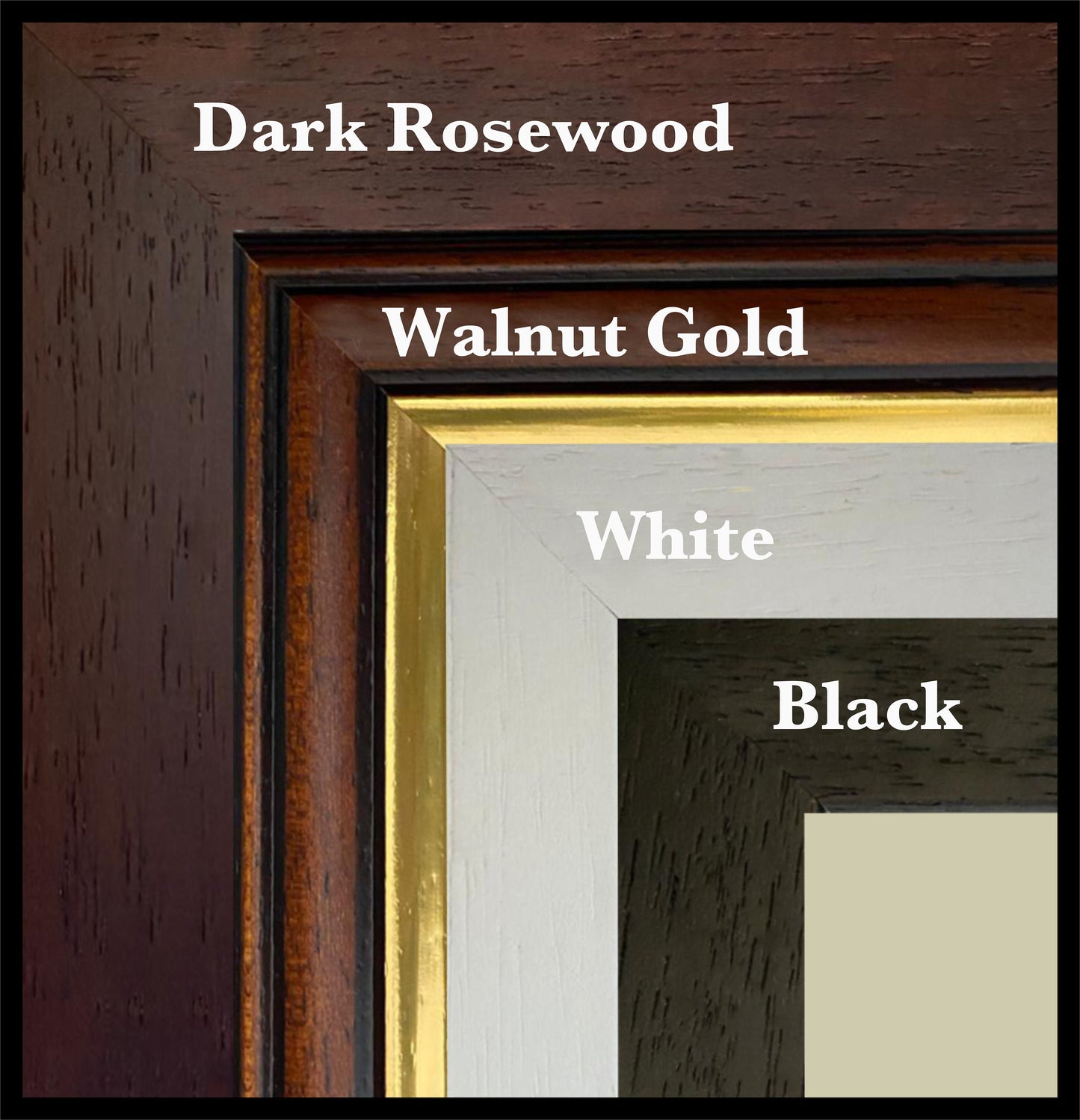
Mounted prints are supplied with an antique white mount as standard, though a black mount is available on request.
Frames are UK-made in solid wood and finished with perspex glazing and an MDF back.
• Black/White – 20mm wide, 15mm deep
• Dark Rosewood – 35mm wide, 15mm deep
• Walnut Gold – 28mm wide, 14mm deep
As wood is a natural material, variations in tone and grain may occur. Not all sizes are available mounted. Sizes refer to the print area.
Attribution
This is an edited version of the following public domain image:
https://commons.wikimedia.org/wiki/File:An_Accurate_Map_of_the_Counties_of_Gloucester_and_Monmouth_Divided_into_their_Respective_Hundreds_-_Collected_from_the_Best_Materials_and_Illustrated_w(i)th_Historical_Extracts_Relative_to_their_Natural_Produce..._-_btv1b53057285g.jpg
th_Historical_Extracts_Relative_to_their_Natural_Produce..._-_btv1b53057285g.jpg)
Share