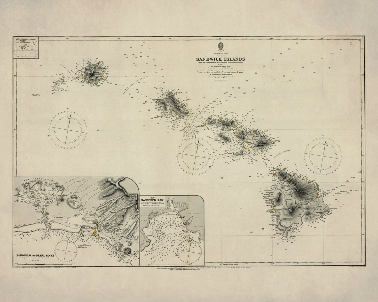
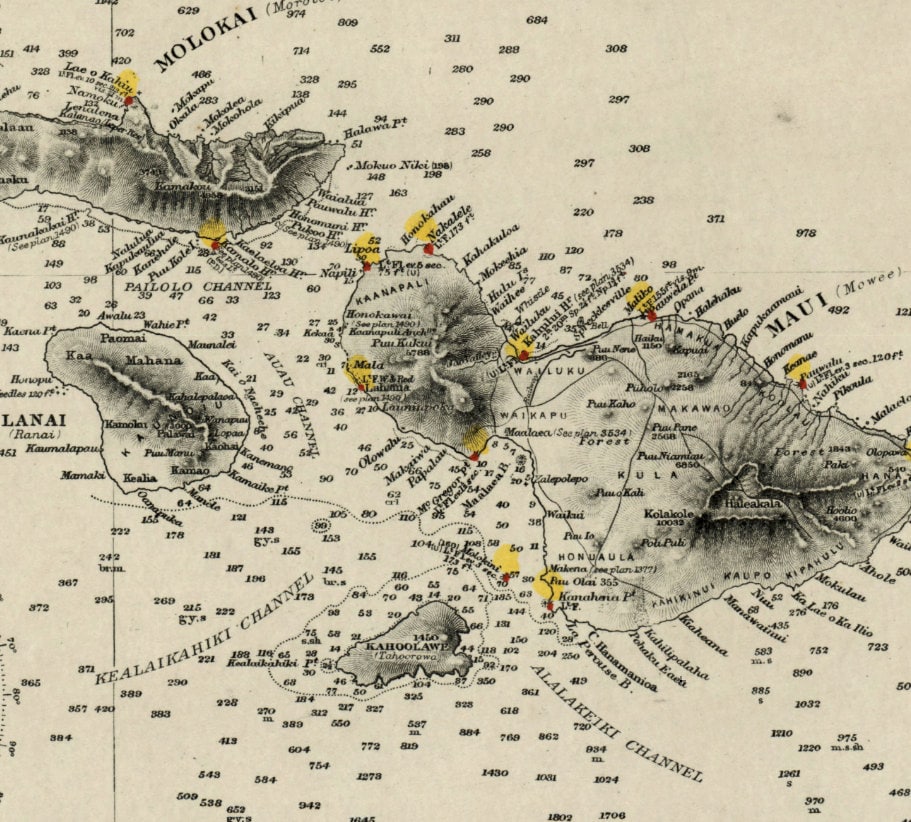
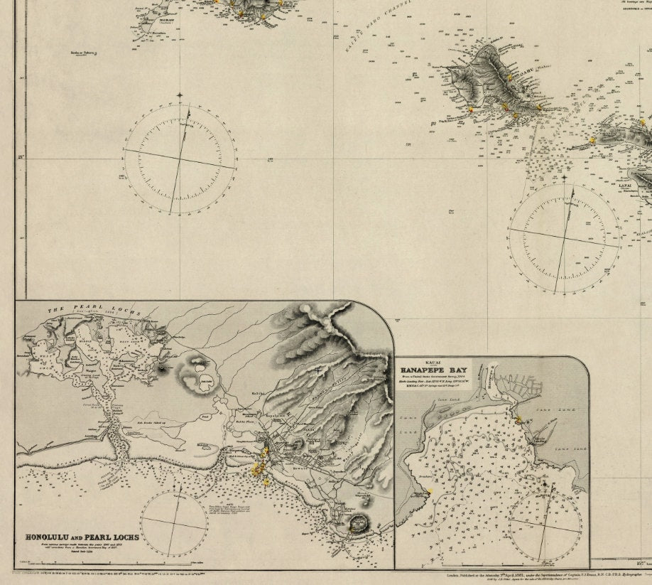
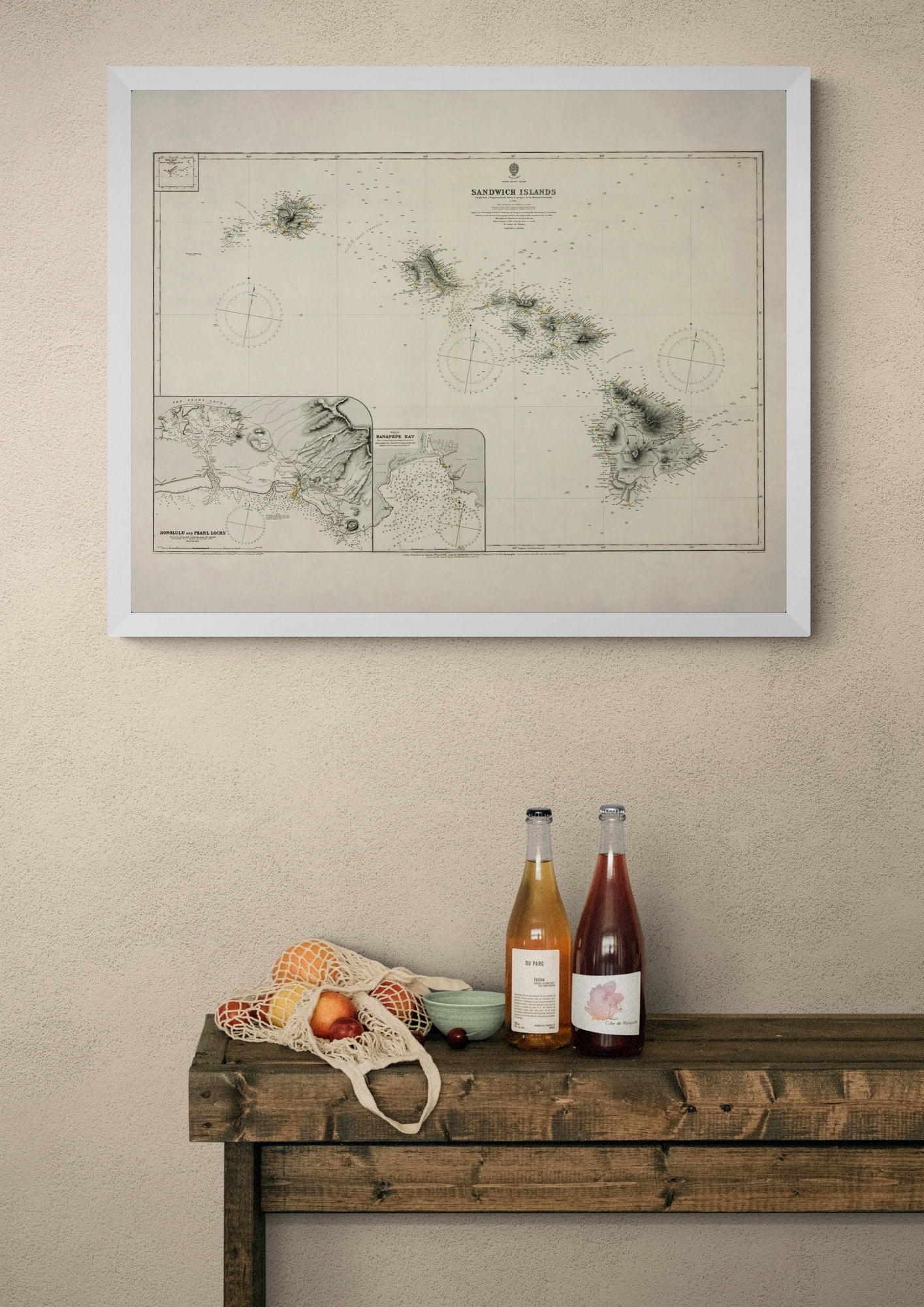
There is something especially evocative about antique maps of Hawaii - they capture the islands before the age of tourism slogans and glossy brochures, when they were charted with a navigator’s eye and a sense of real distance and wonder. This 1885 Admiralty map of the Sandwich Islands is full of that historic appeal, with detailed references to Honolulu, Pearl Lochs and Hanapepe Bay. Ideal for Hawaii lovers, map enthusiasts and anyone with a taste for vintage coastal decor, it brings travel history, maritime character and a beautifully scholarly feel to the wall.
This is an edited reproduction made from antique/public domain source imagery.
Print quality
Printed on beautifully textured 300gsm cotton rag paper using archival pigment inks, this vintage Hawaii map print has a rich, gallery-quality finish designed to bring out every fine line, coastal contour and aged cartographic detail.
Mounting & Framing
Mounting is available in antique white as standard, with black available on request.
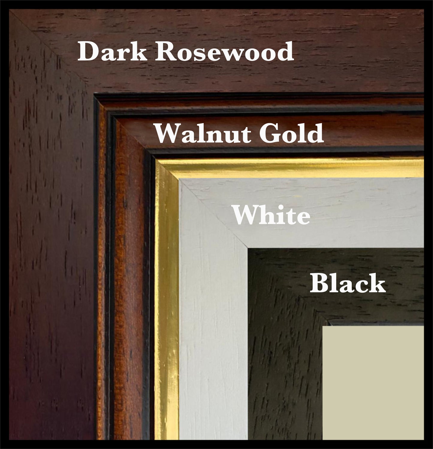
Frame options:
• Black - 20mm wide, 15mm deep
• White - 20mm wide, 15mm deep
• Dark Rosewood - 35mm wide, 15mm deep
• Walnut Gold - 28mm wide, 14mm deep
All frames are UK-made from solid wood and finished with perspex glazing and an MDF back. As wood is a natural material, grain and finish may vary slightly from the photos.
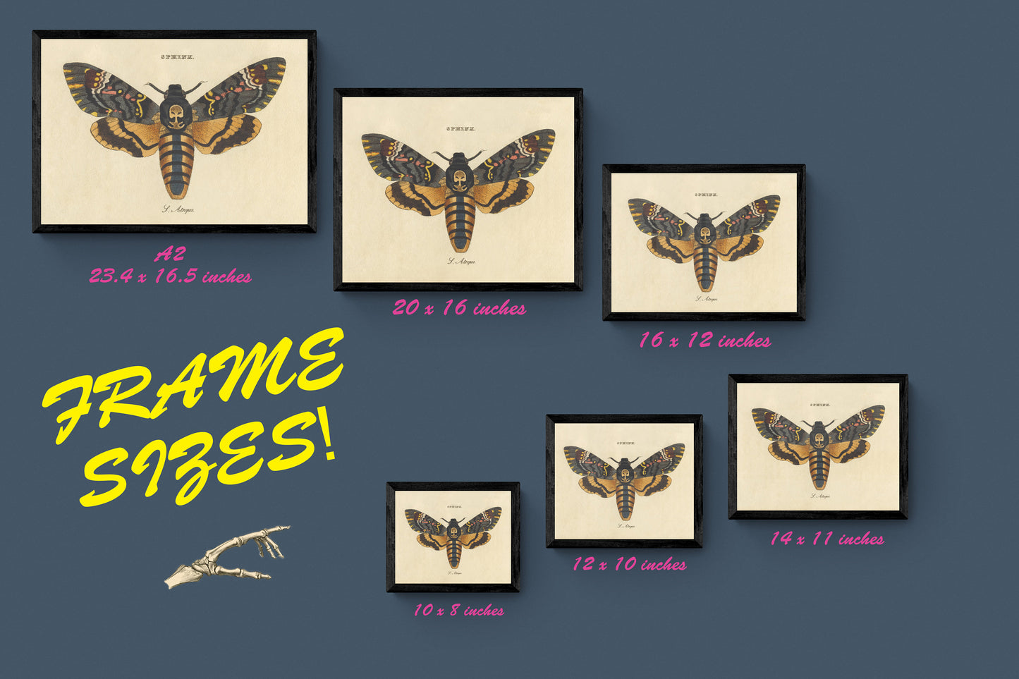
Not all sizes are available mounted. Sizes refer to the print area.
Attribution
This is an edited version of the following public domain image:
https://commons.wikimedia.org/wiki/File:Admiralty_Chart_No_1510_Sandwich_Islands_(Hawaii),_Published_1881.jpg


,_Published_1881.jpg)