Ninska Designs
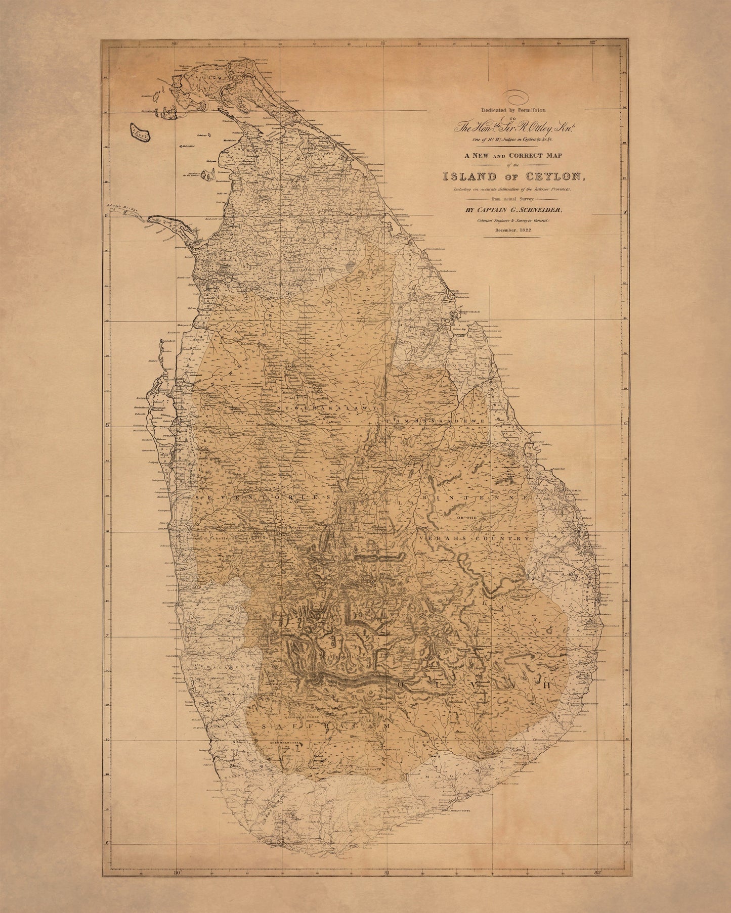
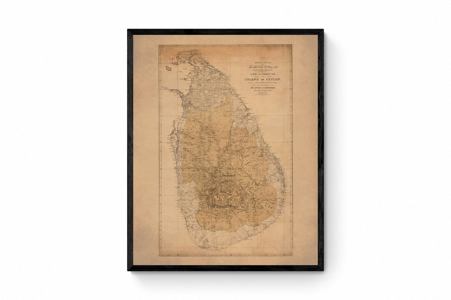
Island of Ceylon Map dated 1822
Island of Ceylon Map dated 1822
Couldn't load pickup availability
There is something especially evocative about an antique island map, and this 1822 map of Ceylon has all the detail and old-world atmosphere that make historic cartography so easy to fall for. Showing the island we now know as Sri Lanka in beautifully intricate period style, it captures coastlines, interior provinces, and place names with the quiet confidence of early 19th-century survey work. It is the sort of print that instantly adds depth to a room - thoughtful, storied, and full of the romance of travel and empire-era mapmaking. This is an edited reproduction made from antique/public domain source imagery.
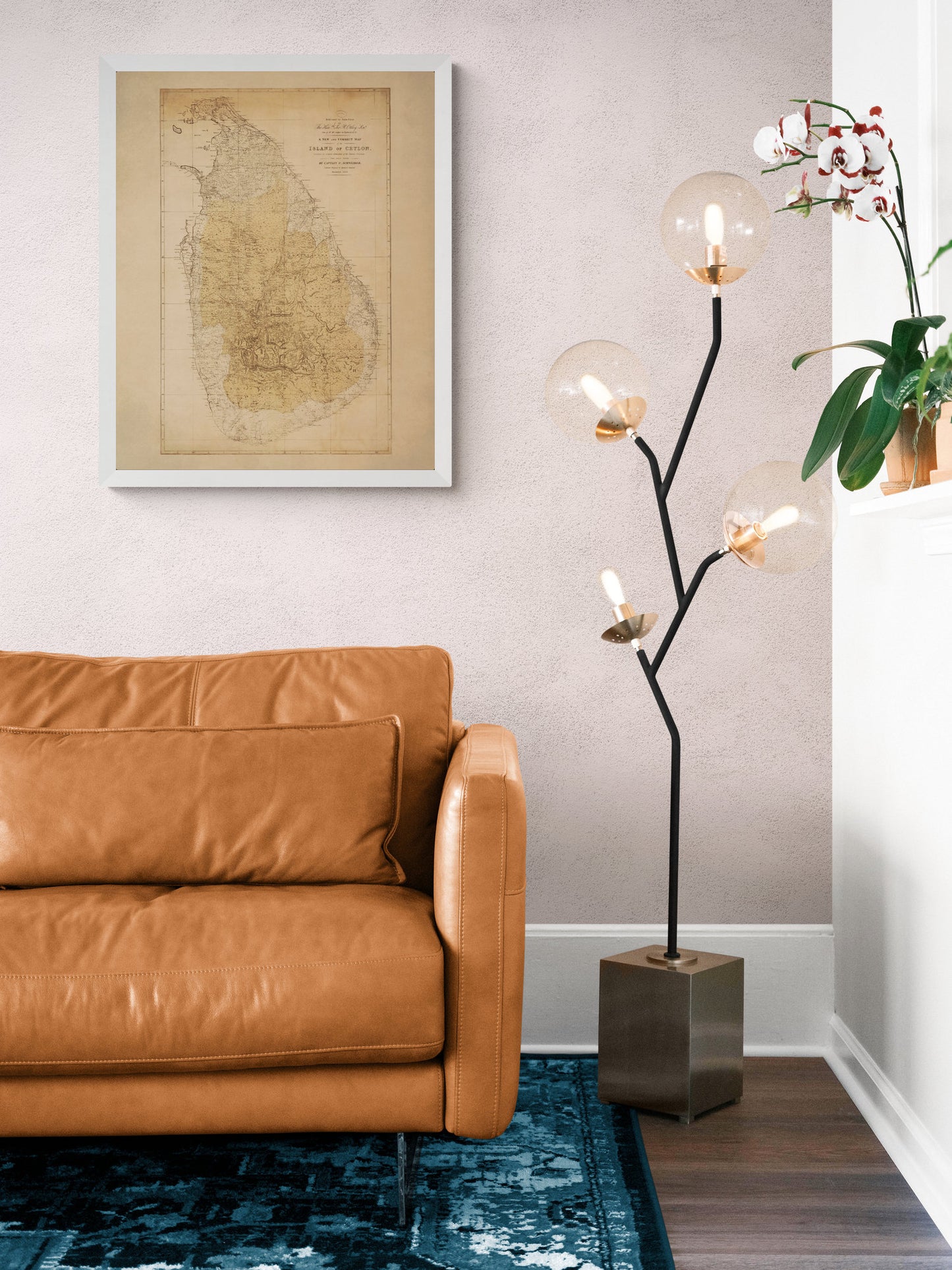
Perfect for a study, hallway, office, library, or travel-inspired interior, this vintage Ceylon map print is a wonderful choice for lovers of antique maps, Sri Lanka history, colonial cartography, and heritage wall art with real character. Whether you have a personal connection to Sri Lanka, an interest in historical geography, or simply a weakness for beautifully detailed old maps, this piece has real presence. It feels both scholarly and decorative, with exactly the kind of quiet intrigue that makes people stop and take a closer look.
Print quality
Printed on 300gsm fine art cotton rag paper using archival pigment inks for superb detail, depth and longevity.
Mounting & Framing
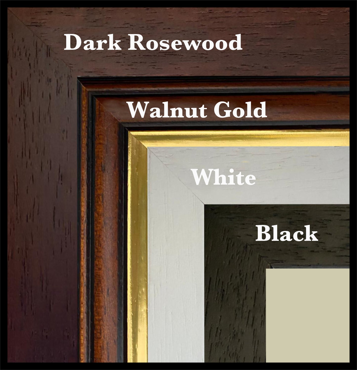
Mounted prints are supplied with an antique white mount as standard, though a black mount is available on request.
Frames are UK-made in solid wood and finished with perspex glazing and an MDF back.
• Black/White – 20mm wide, 15mm deep
• Dark Rosewood – 35mm wide, 15mm deep
• Walnut Gold – 28mm wide, 14mm deep
As wood is a natural material, variations in tone and grain may occur. Not all sizes are available mounted. Sizes refer to the print area.
Attribution
This is an edited version of the following public domain image:
https://commons.wikimedia.org/wiki/File:A_new_and_correct_map_of_the_island_of_Ceylon,_including_an_accurate_delineation_of_the_interior_provinces,_from_actual_survey_-_by_Captain_G._Schneider..._-_btv1b53065058f.jpg
Share