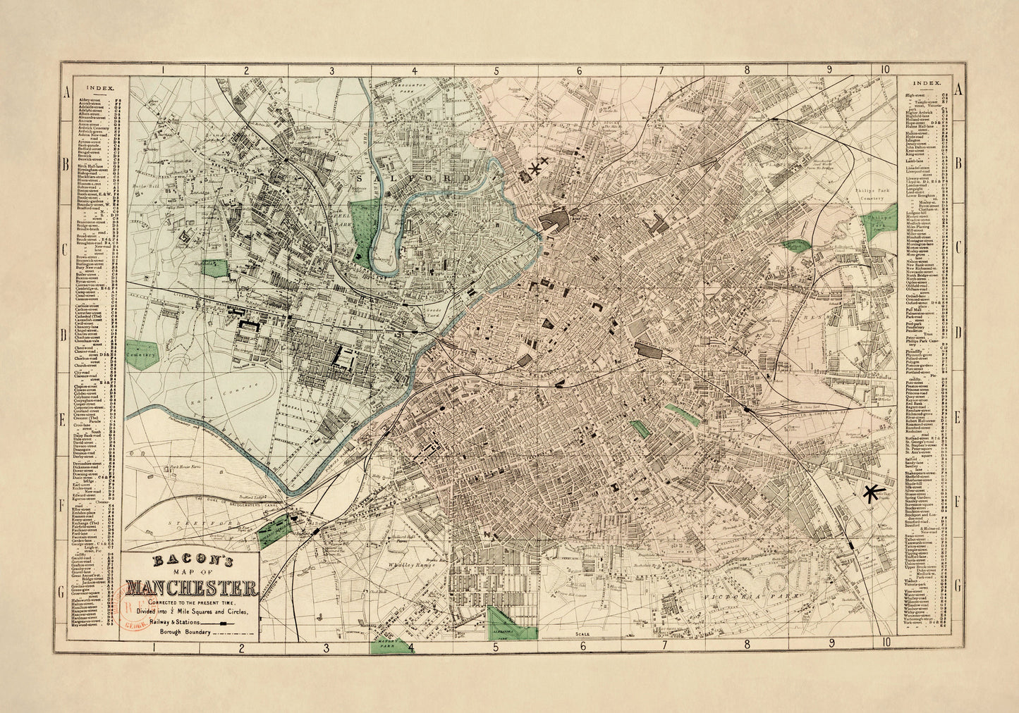
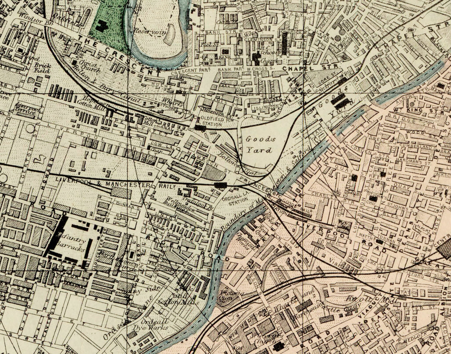
Few cities lend themselves to antique cartography quite like Manchester. By 1887 it was a city of industry, ambition and constant movement, and this vintage plan captures that energy beautifully - from its dense street grid to its railways, stations and borough boundaries. It has all the character of a Victorian city map, making it a brilliant choice for Manchester homes, industrial heritage enthusiasts and anyone who loves wall art with a strong sense of place and history.
This is an edited reproduction made from antique/public domain source imagery.
Print quality
Printed on beautifully textured 300gsm cotton rag paper using archival pigment inks, this vintage Manchester map print has a rich, gallery-quality finish designed to bring out every fine line, street detail and aged cartographic tone.
Mounting & Framing
Mounting is available in antique white as standard, with black available on request.
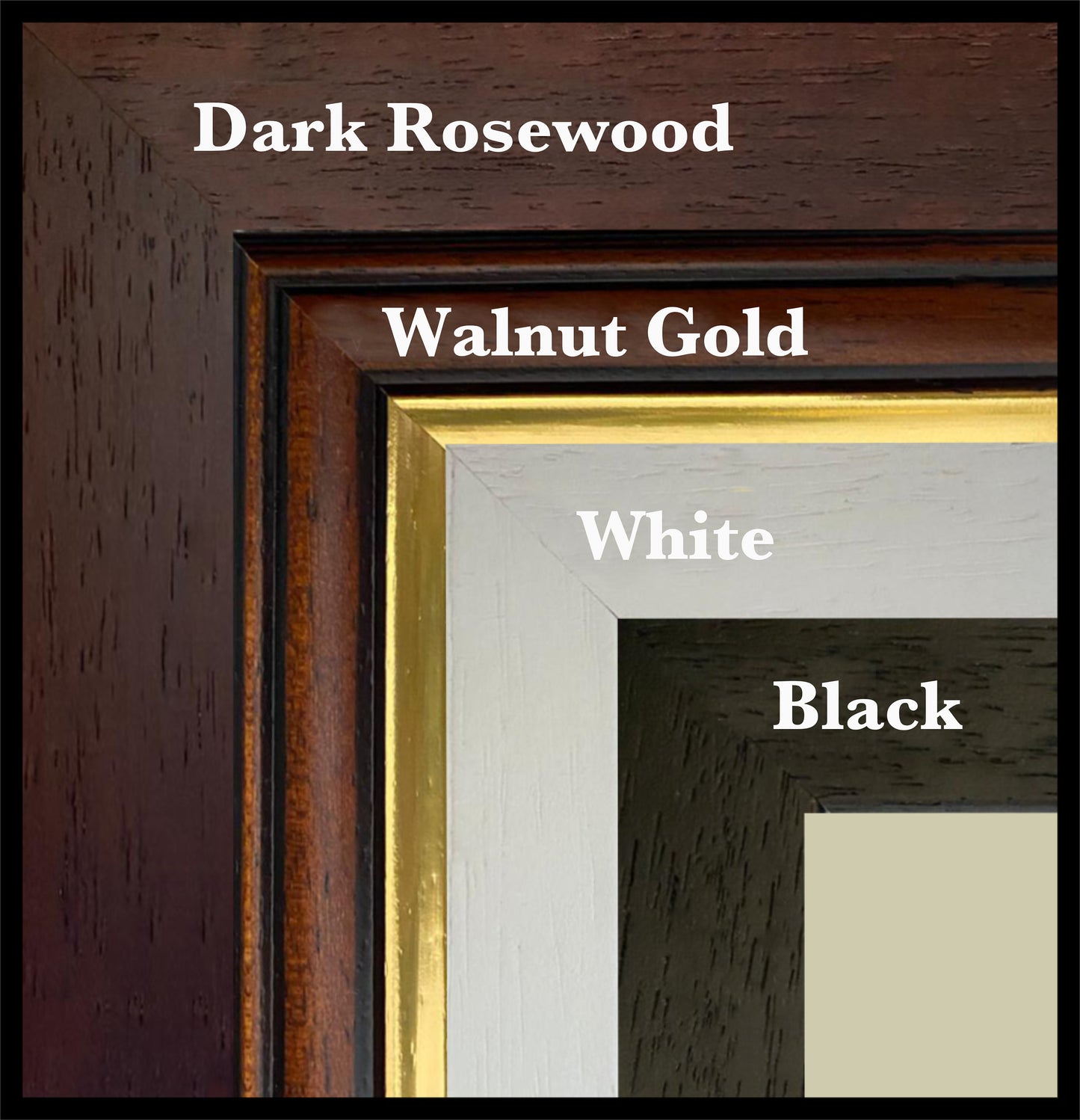
Frame options:
• Black - 20mm wide, 15mm deep
• White - 20mm wide, 15mm deep
• Dark Rosewood - 35mm wide, 15mm deep
• Walnut Gold - 28mm wide, 14mm deep
All frames are UK-made from solid wood and finished with perspex glazing and an MDF back. As wood is a natural material, grain and finish may vary slightly from the photos.
Not all sizes are available mounted. Sizes refer to the print area.
Attribution
This is an edited version of the following public domain image:
https://commons.wikimedia.org/wiki/File:Bacon%27s_Map_of_Manchester,_corrected_to_the_present_time_-_btv1b8439018c.jpg


