Ninska Designs
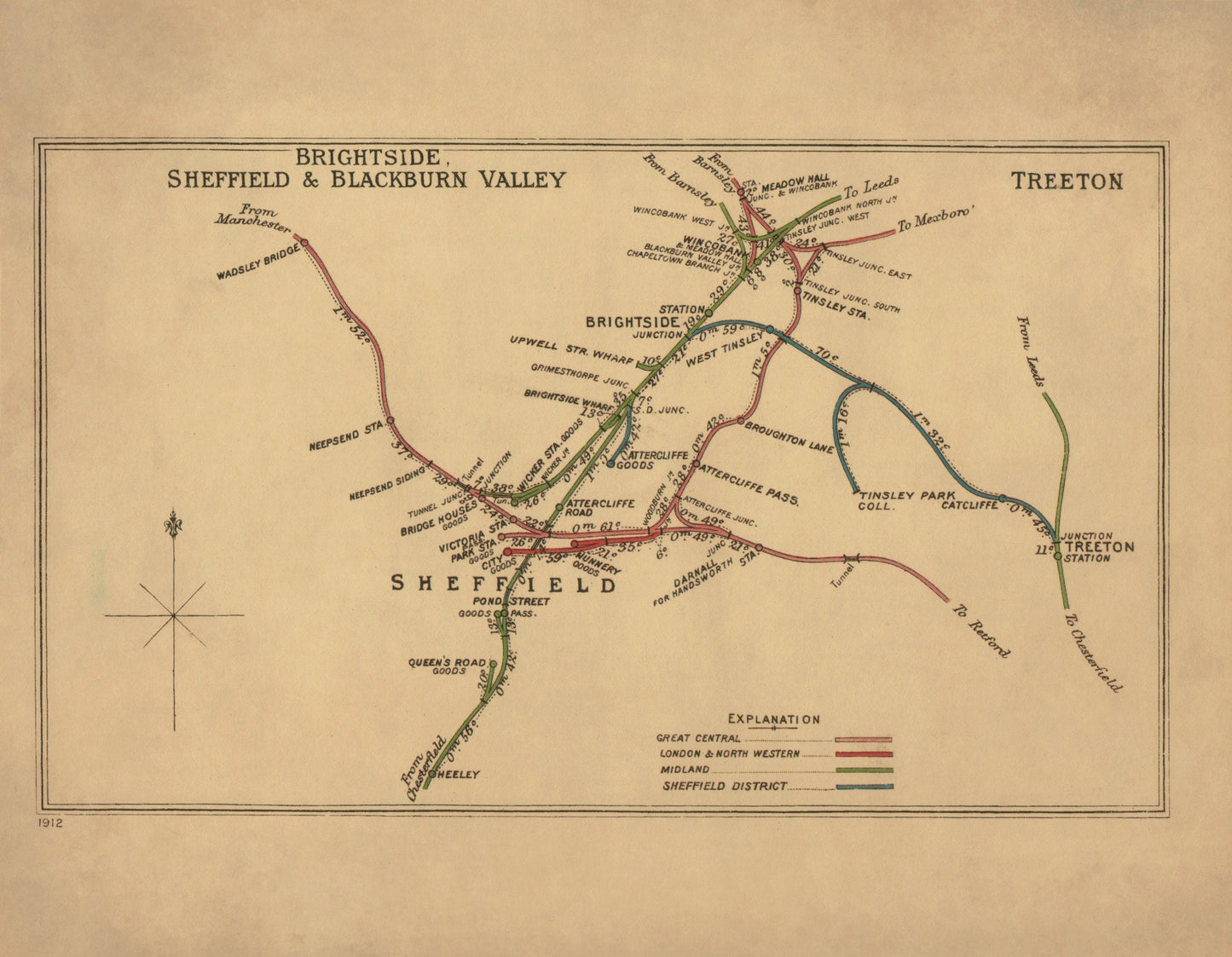
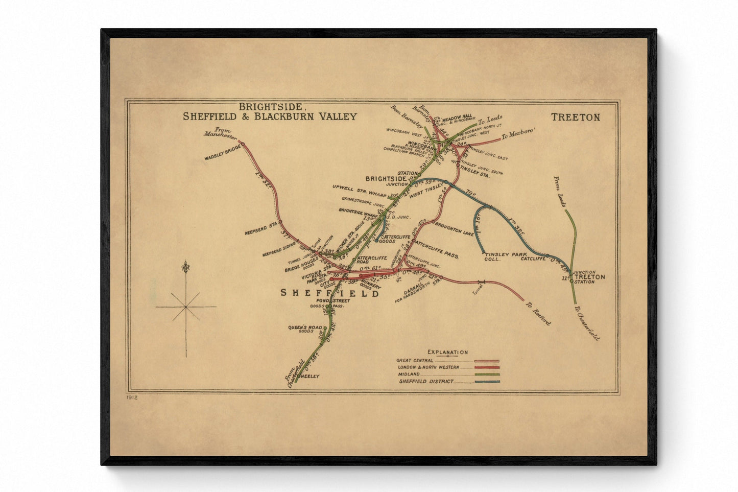
Railway Map 1912
Railway Map 1912
Couldn't load pickup availability
For anyone with ties to Sheffield, this print has real atmosphere. Covering Brightside, Blackburn Valley and Treeton between 1912 and 1914, it captures a landscape shaped by railways, industry and movement - the kind of map that feels part local history, part engineering record, part statement piece. With its network of lines and stations laid out in crisp antique detail, it is perfect for railway enthusiasts, Sheffield homes and anyone drawn to vintage transport maps with strong Yorkshire character.
This is an edited reproduction made from antique/public domain source imagery.
Print quality
Printed on beautifully textured 300gsm cotton rag paper using archival pigment inks, this vintage railway map print has a rich, gallery-quality finish designed to bring out every fine line, route marking and intricate historical detail.
Mounting & Framing
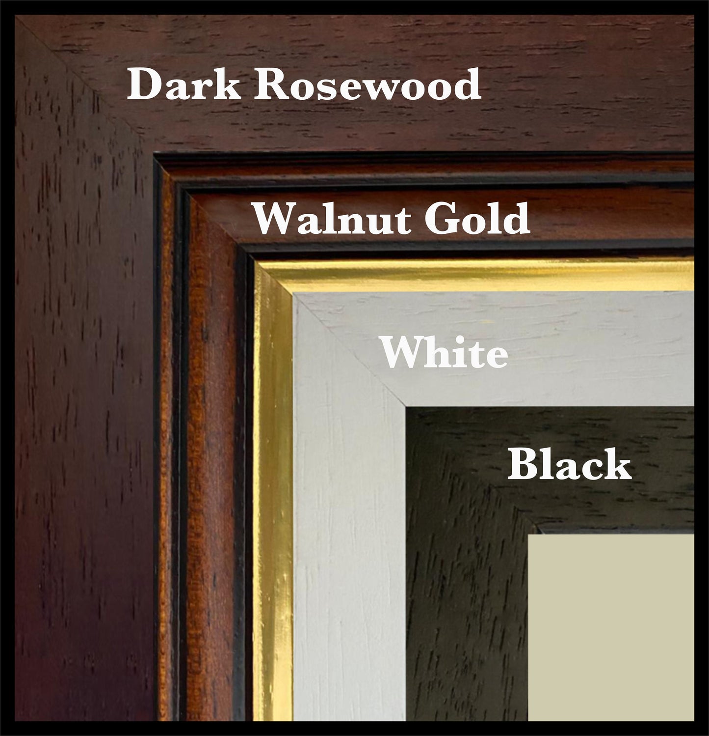
Mounting is available in antique white as standard, with black available on request.
Frame options:
• Black - 20mm wide, 15mm deep
• White - 20mm wide, 15mm deep
• Dark Rosewood - 35mm wide, 15mm deep
• Walnut Gold - 28mm wide, 14mm deep
All frames are UK-made from solid wood and finished with perspex glazing and an MDF back. As wood is a natural material, grain and finish may vary slightly from the photos.
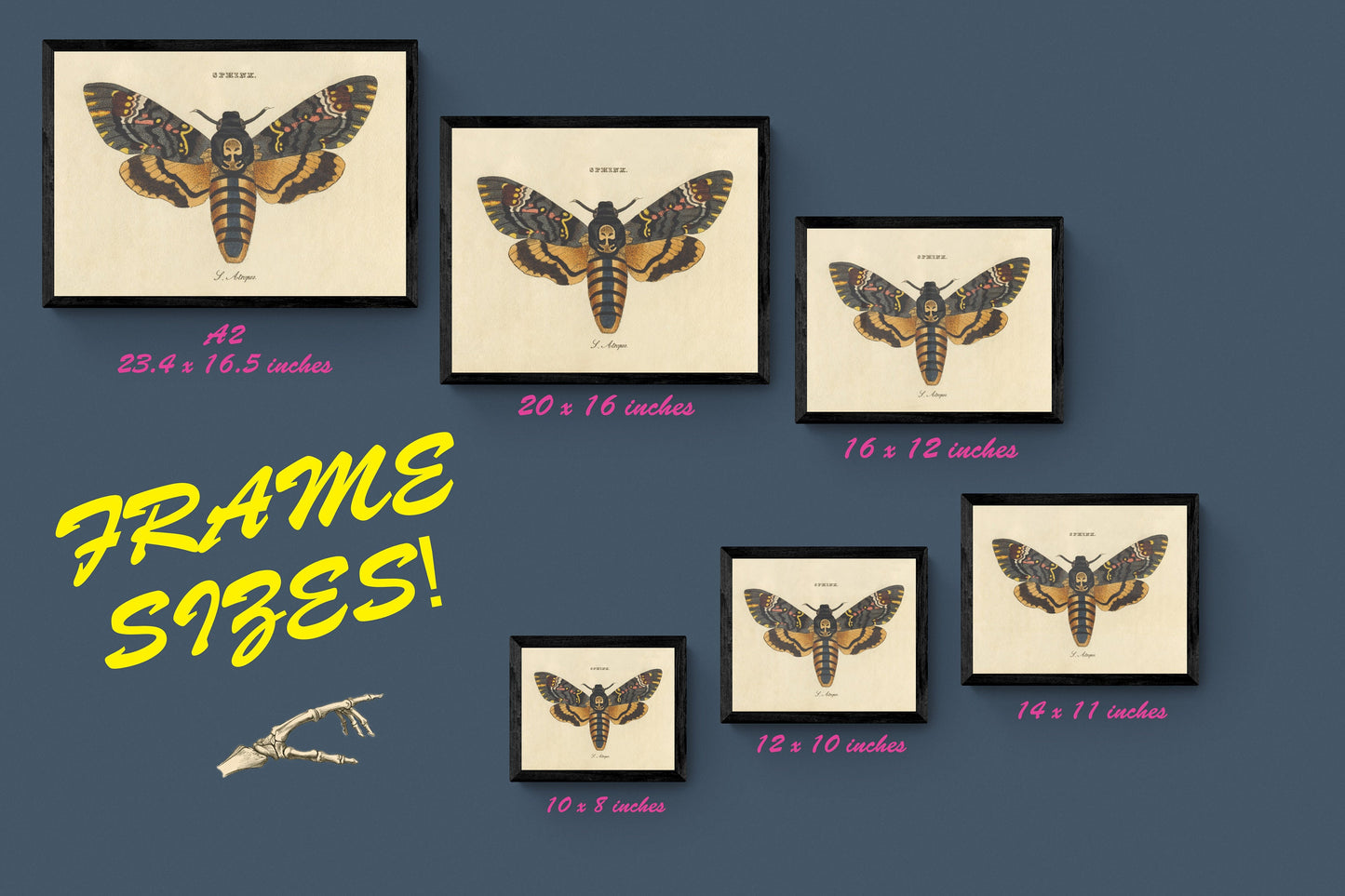
Not all sizes are available mounted. Sizes refer to the print area.
Attribution
This is an edited version of the following public domain image:
https://commons.wikimedia.org/wiki/File:Brightside,_Shefield_%26_Blackburn_Valley_Treeton_RJD_67.jpg
Share