Ninska Designs
The Island of St Christophers alias St Kitts Map dated 1729 - Herman Moll
The Island of St Christophers alias St Kitts Map dated 1729 - Herman Moll
Couldn't load pickup availability
Bring a slice of Caribbean exploration history to your walls with The Island of St Christophers (alias St Kitts) Map (dated 1729) by Herman Moll — a beautifully detailed antique-style map packed with period typography, coastal detail, and old-world cartographic charm. It’s a timeless piece of vintage map wall art for lovers of antique maps, Caribbean history, and nautical exploration décor, and looks especially striking in a study, hallway, office, library, or gallery wall.
This is an edited reproduction of an antique print, created using antique and public domain source imagery.
Print quality
Printed on 300g/m fine art cotton rag paper using archival pigment based ink for crisp detail and long-lasting colour.
Mounting & Framing
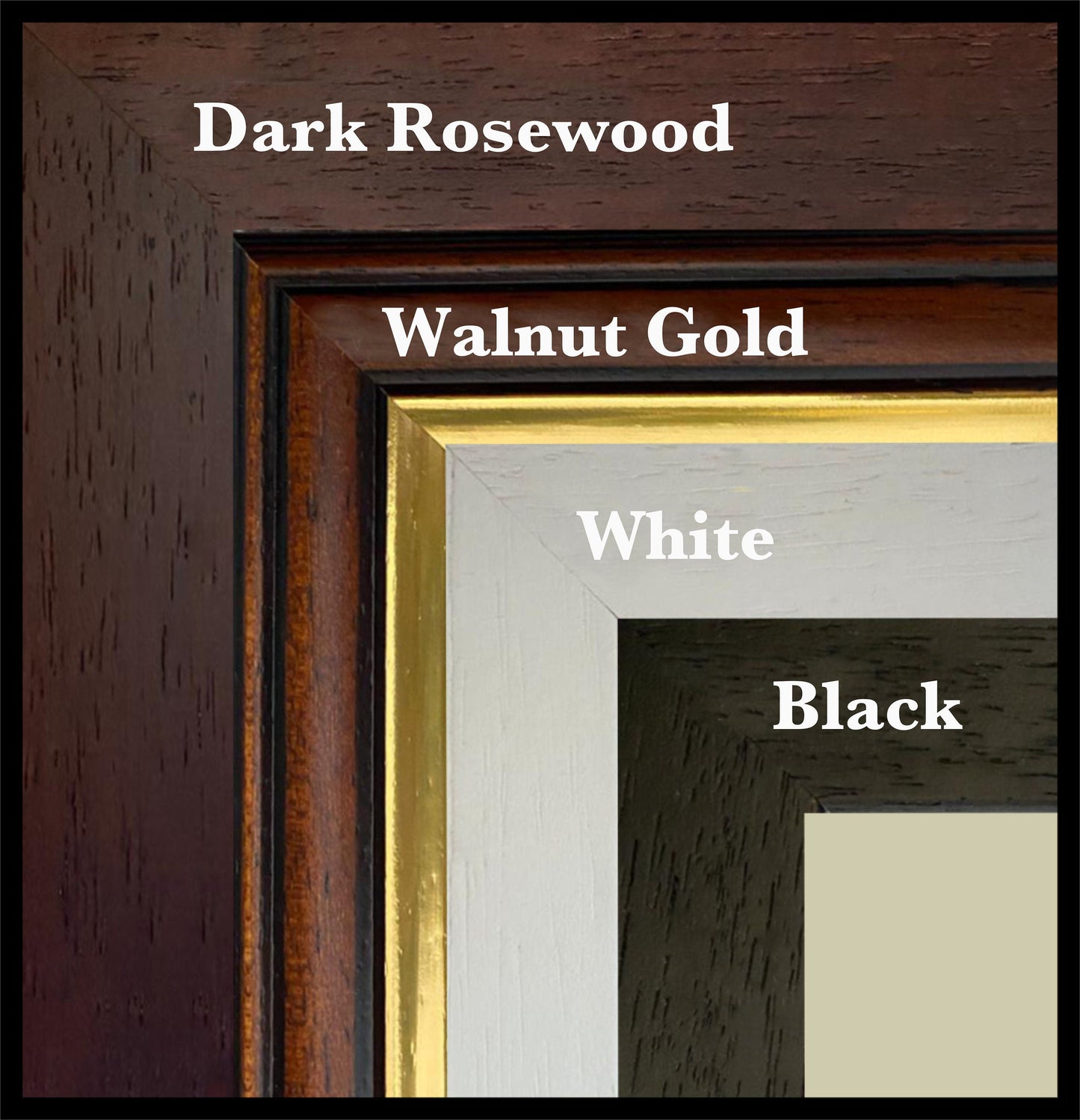
All mounting is antique white as standard (black mounts are available — leave a note with your order if you prefer a black mount instead).
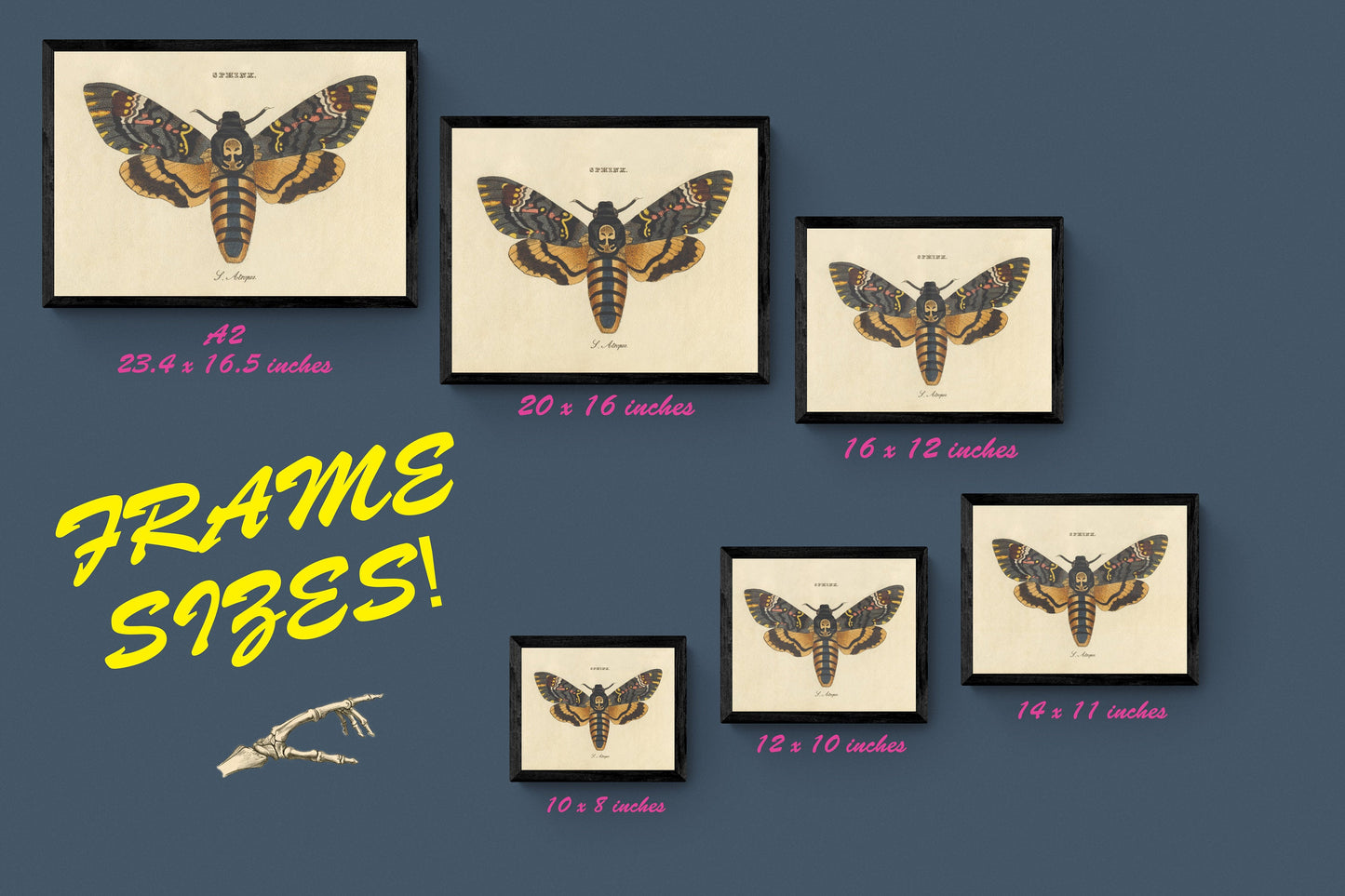
Frame details:
• Black/White finish — 20mm wide and 15mm deep
• Dark Rosewood finish — 35mm wide and 15mm deep
• Walnut Gold Finish — 28mm wide and 14mm deep
All frames are made in the UK from solid wood (usually pine) with a varnish or paint finish. All frames have perspex glazing and an MDF back.
Please note that as wood is a natural material the colour of the finish and grain may vary slightly from the photos.
Licence attribution
Edited version of the following public domain image:
https://commons.wikimedia.org/wiki/File:Moll_-_The_Island_of_St_Christophers_alias_St_Kitts.png
Share