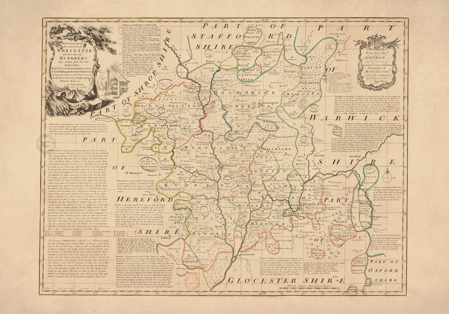
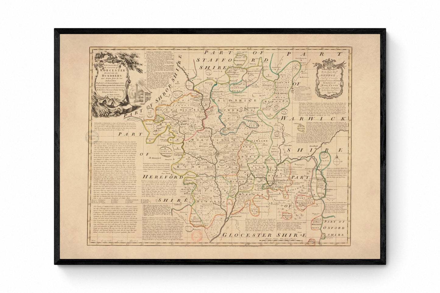
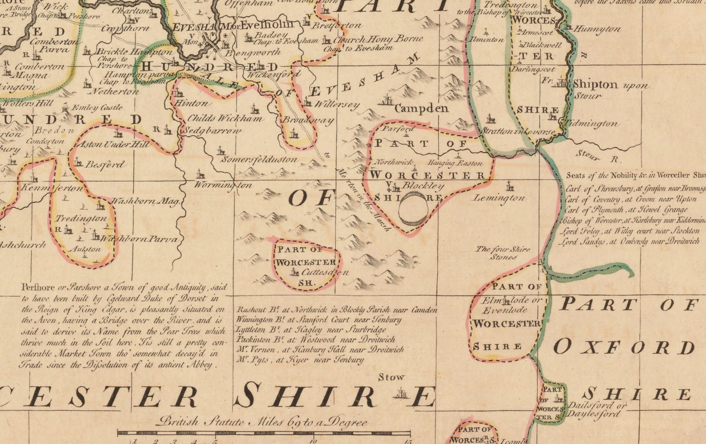
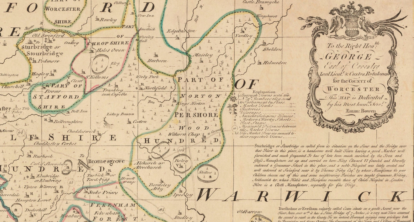
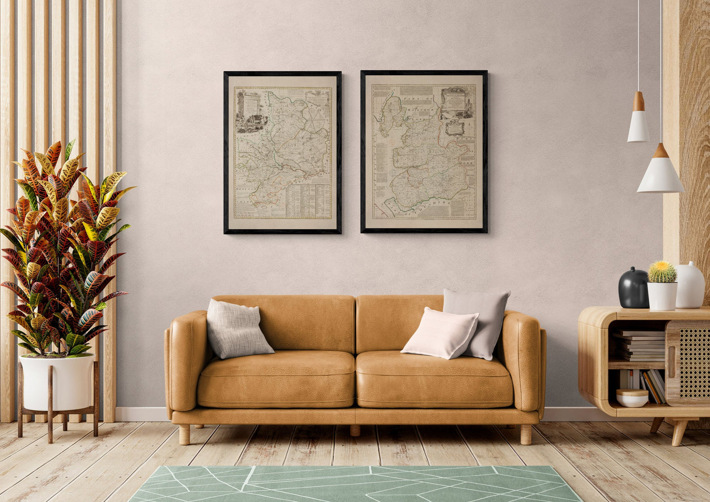
For anyone with a connection to Worcestershire, this print has that lovely mix of local pride and antique elegance. Dated 1756 and originally by Emanuel Bowen, it captures the county in beautifully detailed vintage cartography, with Worcester, Evesham and the surrounding landscape laid out in the rich, careful style that makes old county maps so enduringly appealing. It is the kind of piece that feels equally at home in a study, hallway or country house interior - perfect for Worcestershire residents, local history enthusiasts and collectors of classic British map wall art.
This is an edited reproduction made from antique/public domain source imagery.
Print quality
Printed on beautifully textured 300gsm cotton rag paper using archival pigment inks, this vintage Worcestershire map print has a rich, gallery-quality finish designed to bring out every fine line, aged tone and intricate cartographic detail.
Mounting & Framing
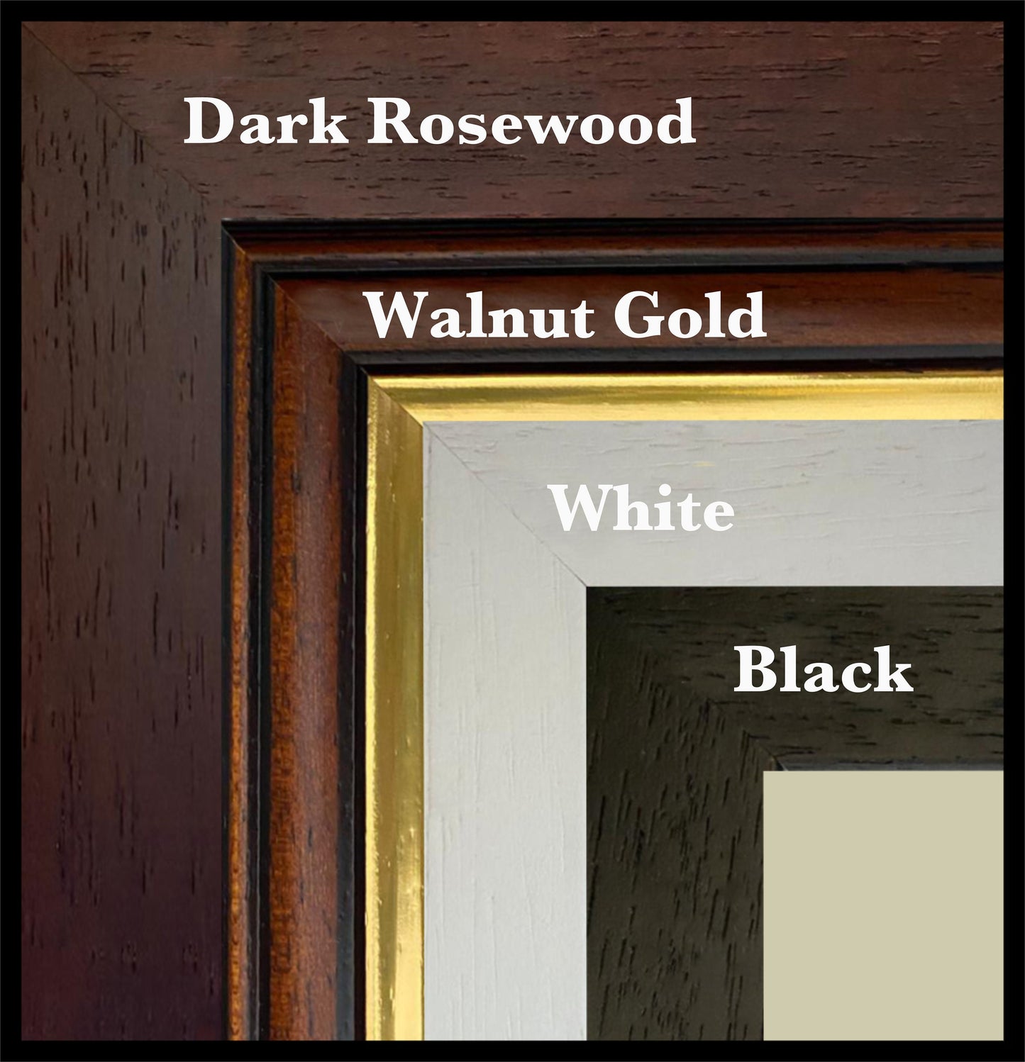
Mounting is available in antique white as standard, with black available on request.
Frame options:
• Black - 20mm wide, 15mm deep
• White - 20mm wide, 15mm deep
• Dark Rosewood - 35mm wide, 15mm deep
• Walnut Gold - 28mm wide, 14mm deep
All frames are UK-made from solid wood and finished with perspex glazing and an MDF back. As wood is a natural material, grain and finish may vary slightly from the photos.
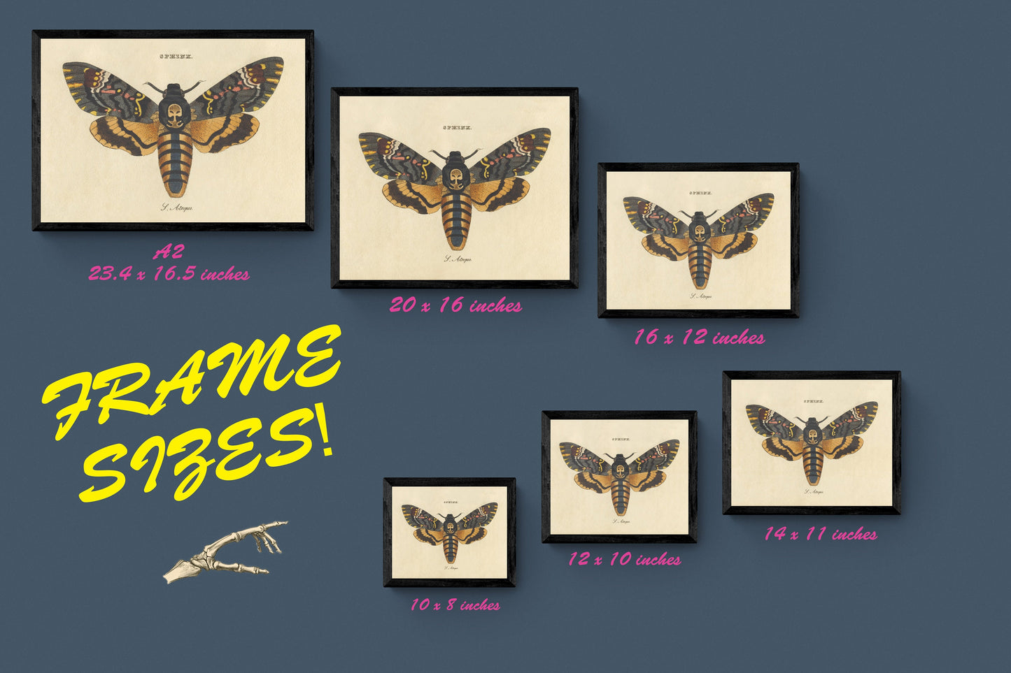
Not all sizes are available mounted. Sizes refer to the print area.